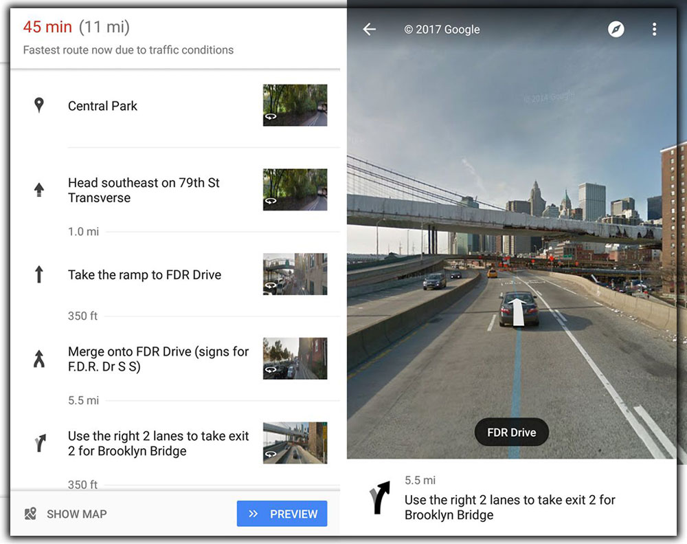
Google Adds Street View Images to Directions so You can See Exactly Where to Turn

BY GreenBot Staff

Published 12 May 2017

Google Street View was finally ready for its close-up in 2017. Google announced a new certification program for 360-degree cameras, letting anyone shoot and upload their interactive experiences to Maps. And now looking to use those images and videos to help get you from point A to point B. The next time you go to start a new drive, you’ll notice something a little different about your route. A new tweak to the Maps interface emphasizes Street View. Showing small pictures of each turn alongside the description, where available. When you tap one of the thumbnails, you’ll get a full view of the scene. With a route marker indicating where to turn or what to do. New to Maps was an even more minor change to the navigation. The bottom navigation bar had been tweaked. As seen above, most screens now include the standard Android navigation bar added. And new explicit buttons to take you to different screens. It’s a matter of taste, but we liked it the old way.
The changes appear beside ones that aren’t tied to specific updates, but if you aren’t seeing them, as a last result, you could try side-loading the latest Maps from A Mirror. The new Street View images aren’t active in the iOS app.
The impact on You on the road: Adding Street View pictures is a small change, one most people aren’t likely to notice. But it could be the start of a greater emphasis on real-world mapping. Maps are by far the best navigation app on our phones. But being able to traverse more of the world with actual imagery would put it in a class by itself.